Midweek cold front brings relief from the heat
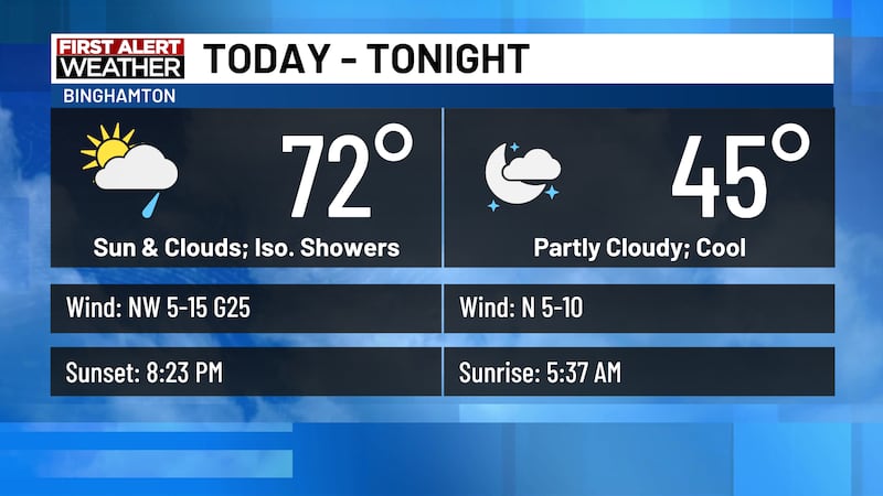
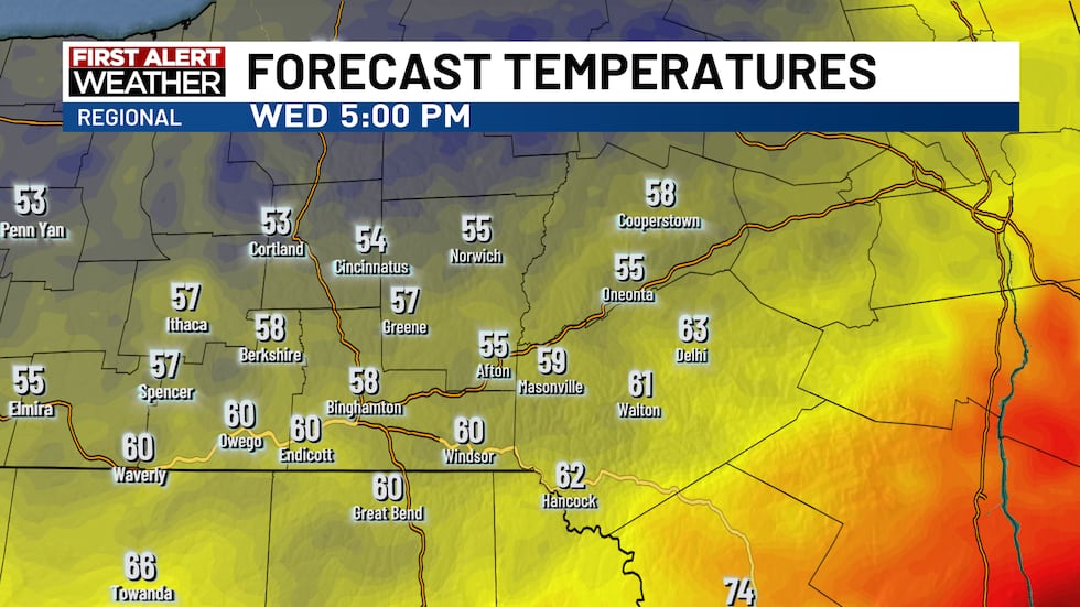
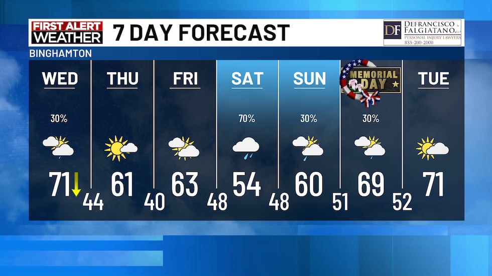
(WBNG) - The mid-summer heat is set to vacate the area behind a cold front Wednesday morning. The front sinks south through the morning and clears the area by late afternoon. Temperatures will likely top out early in the day north, but south, highs should get back into the 70s. They are expected to drop as the front moves through.
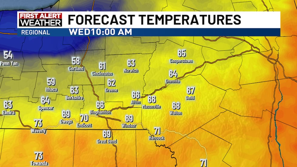
50s to near 60 degrees should be found by evening. Any mugginess will be swept out of the area so sleeping conditions for those without A/C will be much more comfortable.
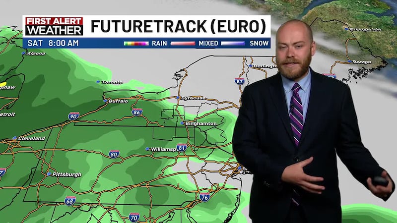
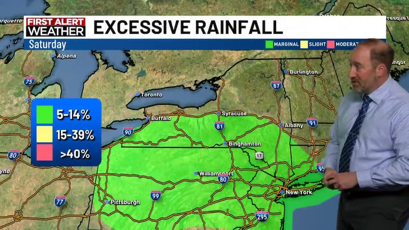
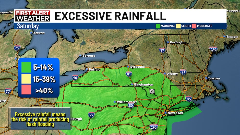
Our next forecast challenge this week is how much rain will fall Saturday. An upper level disturbance develops over the Great Lakes and pushes into the northeast. It will tap into some southern moisture and, coupled with the slow movement, could produce steady to heavy rain. The WPC does have the entire WBNG viewing area under the MARGINAL risk of excessive rainfall. Fine details emerge as the week progresses.
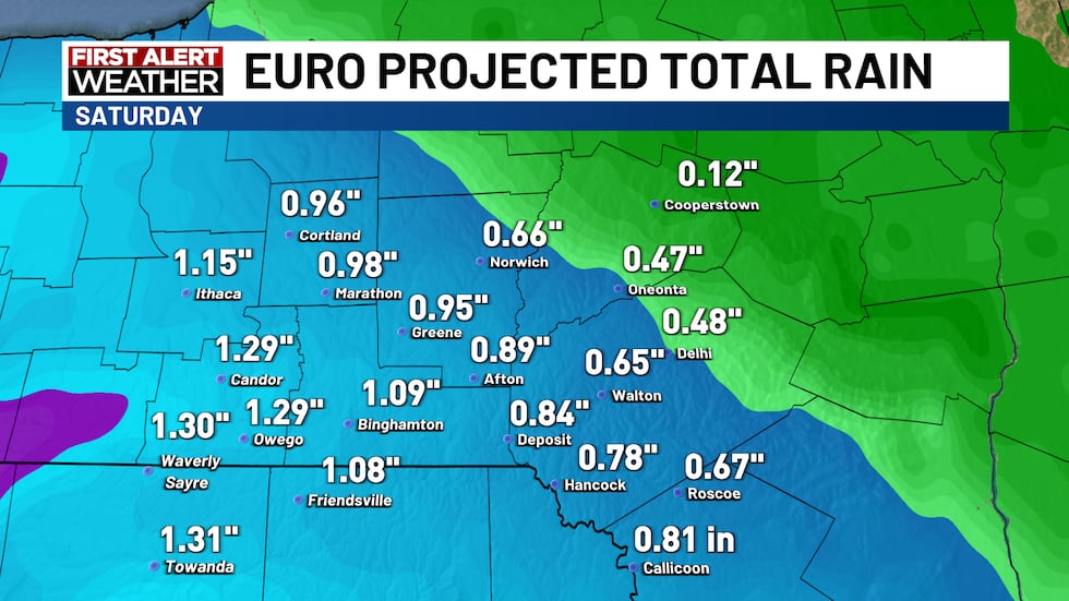
The European weather model shows over an inch of rain through the day for areas around Binghamton, but lower totals farther northeast.
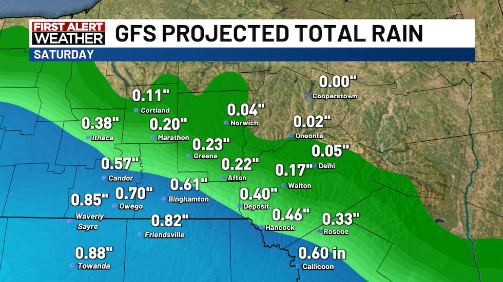
The GFS weather model has lowest amounts northeast, but like the EURO, it has steadiest rain near and south/southeast of Binghamton.
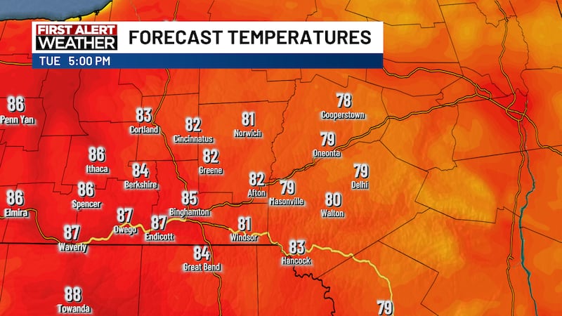
The next 7 days bring relief from the heat and a return to much more seasonable temperatures. It does look like parts of Memorial Day weekend will be wet, and we have introduced a small chance of some rain for the holiday.
Copyright 2026 WBNG. All rights reserved.