More comfortable conditions as we wrap up the workweek
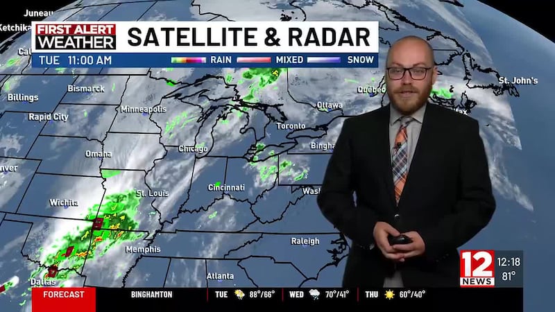
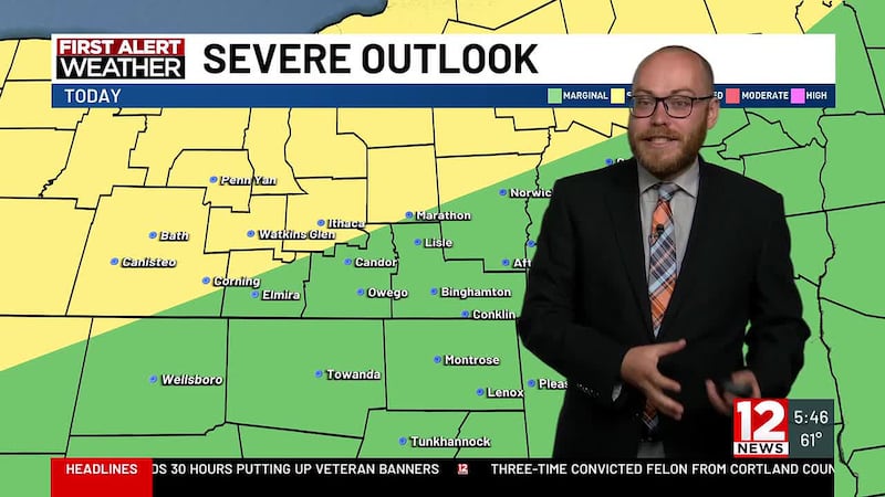
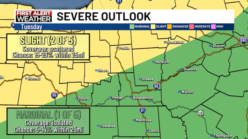
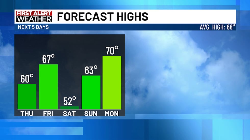
Today: Cloudy early with showers before clearing late. Temperatures drop into the 60s. Chance of rain 30%. Wind: NW 5-15 G25. High: 67-73↓.
Tonight: Partly cloudy and cool. Wind: N 5-10. Low: 40-47.
Thursday: Mostly sunny. Much cooler. Wind: N 5-10. High: 56-63.
Thursday Night: Mainly clear and cool. Patchy frost. Wind: L & V. Low: 37-43.
Friday: Sun and clouds. Increasing clouds late. High: 67. Low: 48.
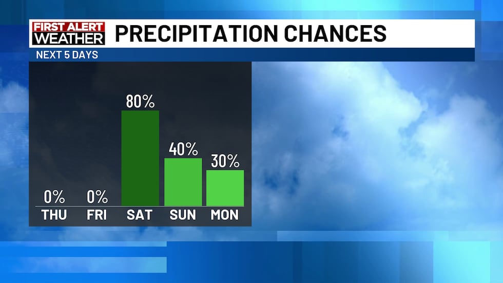
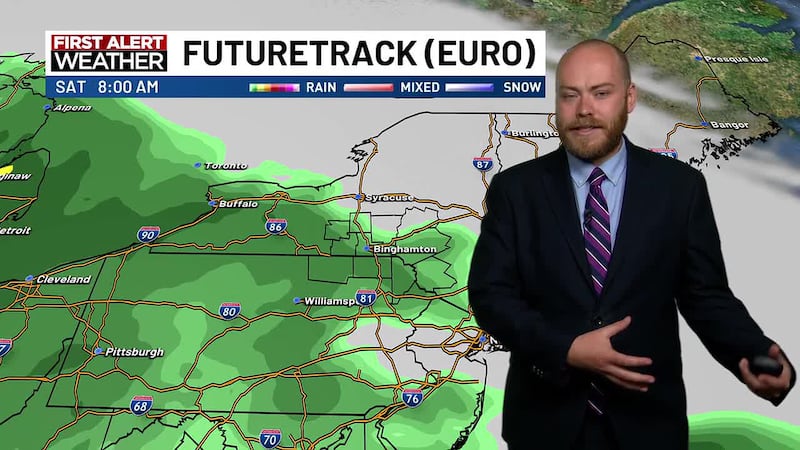
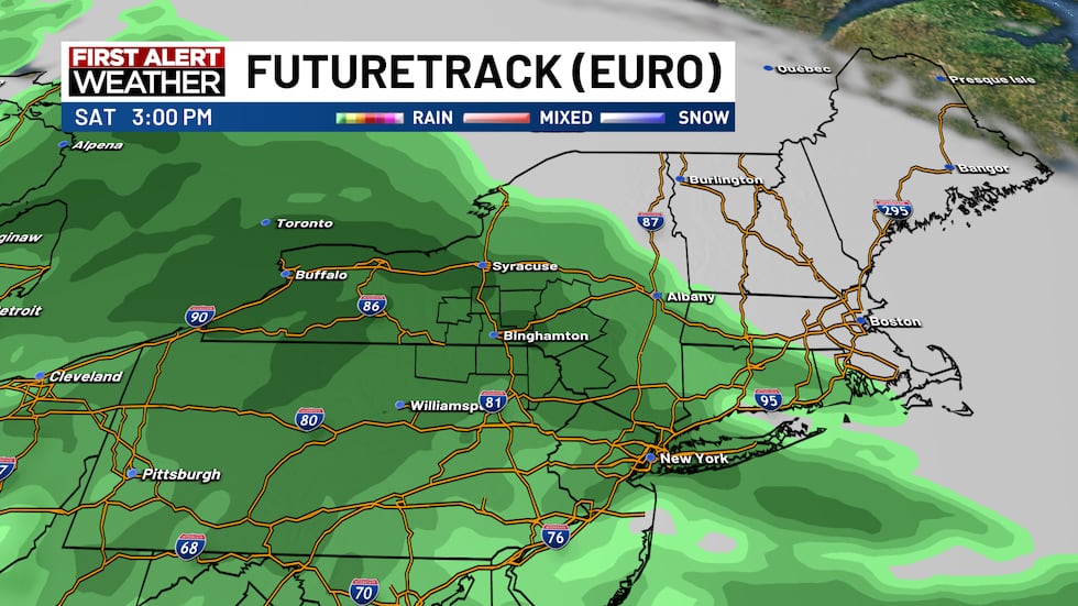
Saturday: Mostly cloudy with rain showers. Cool. Chance of rain 80%. High: 52. Low: 47.
Sunday: Mainly cloudy with showers. Chance of rain 40%. High: 63. Low: 51.
Memorial Day: Mostly cloudy with isolated showers. Chance of rain 30%. High: 70. Low: 54.
Tuesday: Sun and clouds. High: 73. Low: 55.
Forecast Discussion:
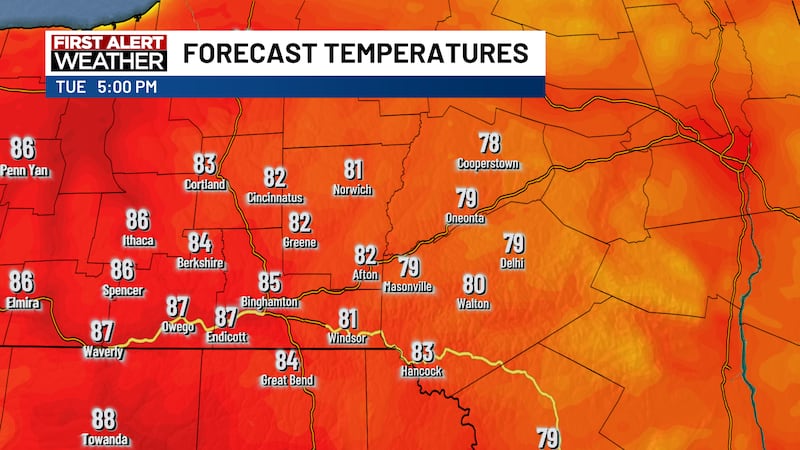
A cold front will move through the region today, ushering in some scattered rain showers and cooler temperatures, with temperatures being in the 60s most of the day after early highs in the low-70s. An area of high pressure will slide eastward, allowing for clearing skies overnight and cool conditions, with lows in the 40s.
Thursday will be a wonderful but cool day, as highs will only reach 60 under mostly sunny skies thanks to the high-pressure system. Overnight lows will fall into the low 40s, with a few locations falling into the 30s, leading to the risk of patchy frost. Friday will be dry and seasonable, with highs in the mid-to-upper 60s under a mix of sun and clouds. Clouds will gradually increase ahead of the next weather system.
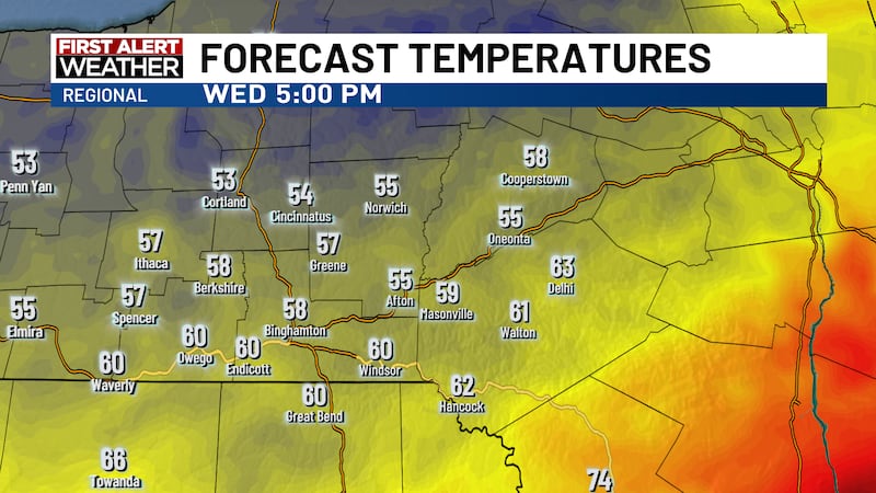
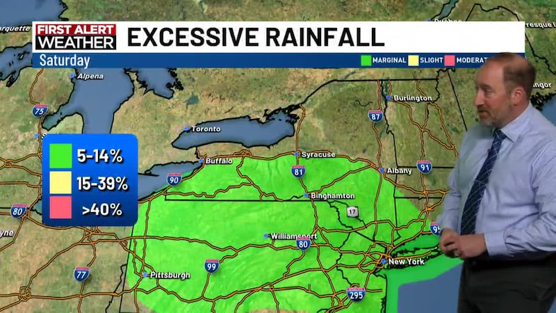
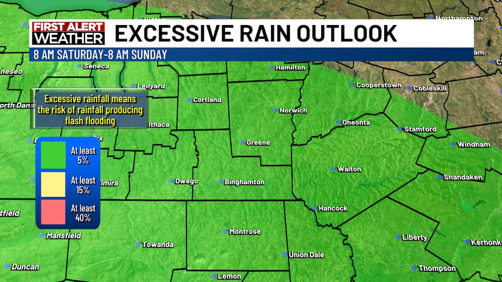
An area of low pressure moving in from the south will allow for rain to fall throughout the day. Rain will be steady, allowing for a small risk of excessive rainfall that could produce flash flooding. We will monitor the forecast for any changes. It will be cool, with highs only in the low-50s. Sunday will feature early showers, with highs in the low-60s.
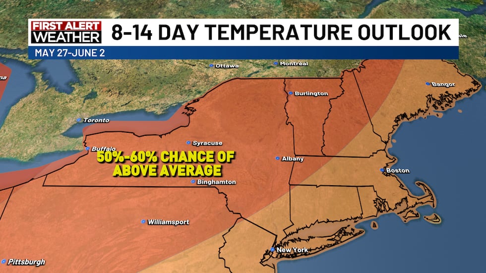
Memorial Day will be mainly cloudy with a few isolated showers. Highs will be seasonable, with temperatures maxing out near 70. High pressure will slide in for Tuesday, allowing for some sunshine and highs nearing the mid-70s.
Copyright 2026 WBNG. All rights reserved.