Sweltering heat remains, but changes arrive soon
**HEAT ADVISORY FOR BROOME, TIOGA, TOMPKINS, SUSQUEHANNA, AND BRADFORD COUNTIES UNTIL 8 PM WEDNESDAY**
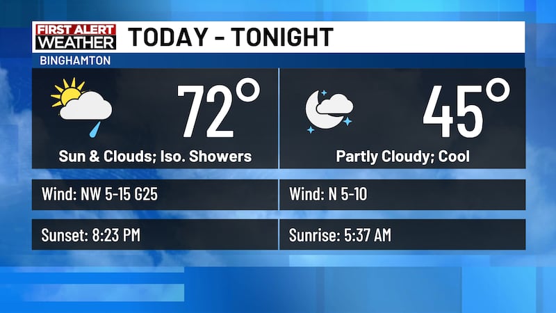
Today: Mostly sunny. Hot and humid. Wind: NW 5-10. High: 84-92.
Tonight: Clear. Mild. Patchy fog. Wind: Calm. Low: 63-68.
Wednesday: Sun and clouds. Hot and humid. Afternoon storms. Chance of rain 40%. Wind: W 5-10. High: 85-93.
Wednesday Night: Cloudy with scattered showers. Chance of rain 60%. Wind: N 3-7. Low: 63-69.
Thursday: Mostly cloudy. Scattered showers. Chance of rain 60%. High: 73. Low: 55.
Friday: Sun and clouds. High: 72. Low: 52.
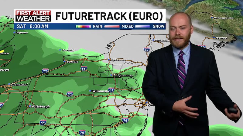
Saturday: Sunny. Comfortable. High: 75. Low: 53.
Sunday: Sunny. High: 80. Low: 57.
Monday: Mostly sunny. High: 82. Low: 59.
Forecast Discussion:
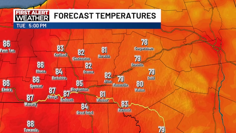
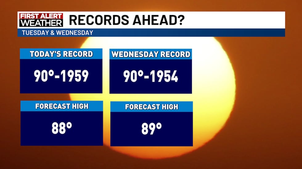
The hot and humid conditions continue today, with highs reaching the upper 80s and low 90s. With dewpoints in the upper 60s, heat index values will climb into the mid-90s. A Heat Advisory will go into effect for Broome, Tioga, and Tompkins Counties in New York, and Susquehanna and Bradford Counties in Pennsylvania, starting at 11 AM. Skies remain clear overnight, with lows in the mid-60s and patchy fog developing by daybreak.
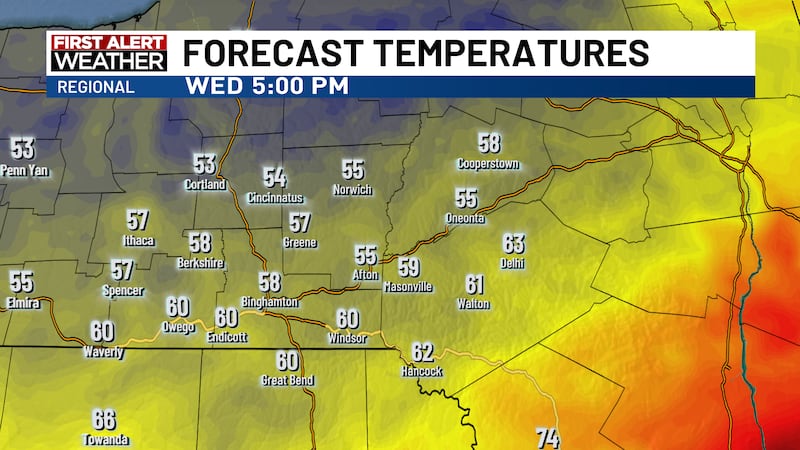
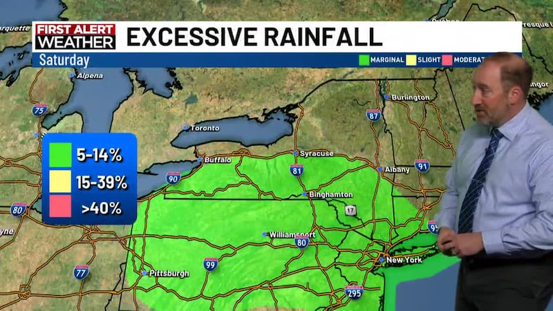
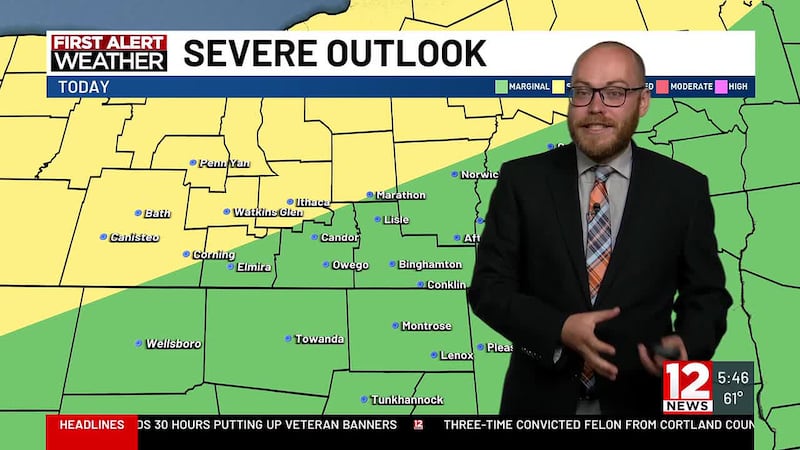
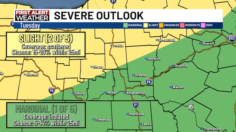
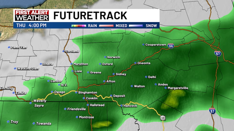
Heat Advisories remain in place for Wednesday, as highs will reach nearly 90, with heat index values once again in the mid-to-upper 90s. A frontal boundary will start to approach the region during the afternoon, which will set up the potential of some strong-to-severe thunderstorms. The SPC has the region under a marginal risk of severe weather, with winds being the biggest risk if any severe storms develop. The front will continue to push south throughout the night, allowing rain to continue to fall. There is a small chance there could be some heavy rainfall rates, but most of those look to be well south of the area. Thursday, the rain will continue as the area is between two areas of high pressure. There is another small chance of heavy rainfall, but like the overnight period, the biggest risk of that will be south of the Southern Tier. The WPC has the region under a marginal risk of excessive rainfall. It will be cooler on Thursday, with highs only in the low 70s.
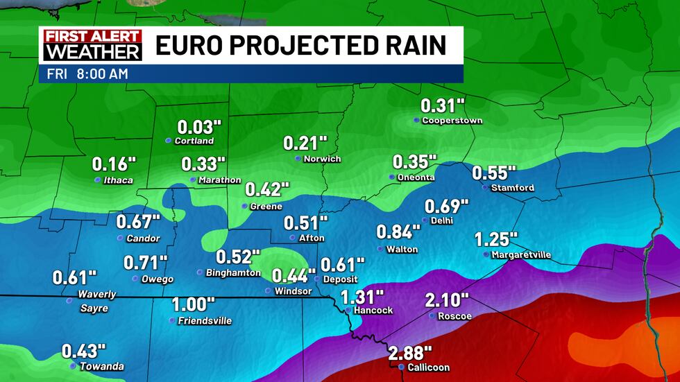
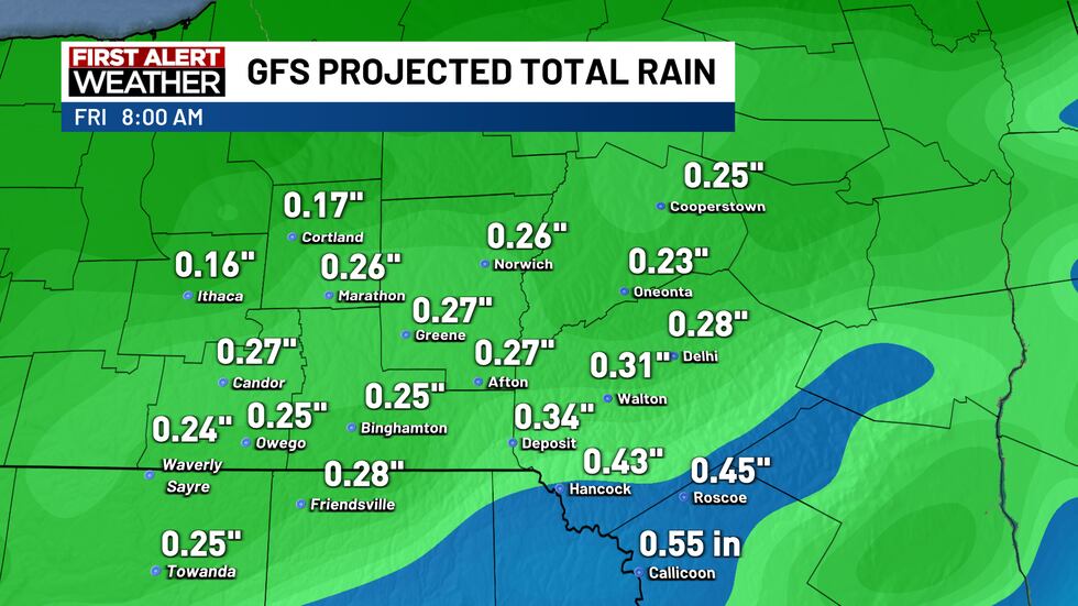
Rain will taper off by Friday morning, allowing for skies to clear. Highs will be cool, with most spots only reaching the low 70s.
High pressure builds back in for the weekend and the beginning of next week, allowing for plenty of sunshine and comfortable conditions. Highs on Saturday will reach the mid-70s, with highs on Sunday reaching 80. Monday will see mostly sunny skies and highs in the low 80s.
Copyright 2025 WBNG. All rights reserved.